
This lesson focuses on understanding information signs and directional indicators, crucial for navigating the Dutch road network on your AM-class vehicle. It builds upon your knowledge of basic traffic signs by introducing guidance, route, and service signs, as well as the important 'built-up area' markers. Mastering these signs is key for exam success and confident riding.
Welcome to this comprehensive lesson on interpreting information signs and directional indicators within the Dutch road network. For all road users, and especially for those with a Category AM license operating a moped or scooter, a thorough understanding of these signs is vital for safe, efficient, and lawful navigation. Unlike regulatory signs that command specific actions, information signs provide crucial context about your surroundings, upcoming routes, services, and changes in traffic rules, such as speed limits when entering or leaving a built-up area.
This chapter of your Dutch Driving License Theory Course for Category AM will equip you with the knowledge to correctly identify and react to these non-binding yet critical visual cues. We will explore how these signs influence your route planning, speed choices, and awareness of the environment, ensuring you can ride confidently and responsibly on Dutch roads.
Information signs, in contrast to regulatory or warning signs, do not impose direct legal obligations or prohibitions. Instead, they serve as navigational aids, provide contextual data, or indicate the presence of services. For Category AM riders, interpreting these signs correctly is paramount. They help anticipate changes in road conditions, prepare for turns, understand the hierarchy of roads, and ensure compliance with speed limits tied to specific zones.
The underlying logic behind these signs is multifaceted. From a safety perspective, anticipating upcoming destinations or changes in the environment reduces the need for sudden maneuvers and improves reaction time, which is critical for vulnerable moped riders. For efficiency, proper use of route numbering and directional signs enables smoother traffic flow and helps riders stay on their intended path. Legally, while an information sign itself might not be enforceable, ignoring the information it conveys (e.g., failing to slow down at a "beginning of built-up area" sign) can lead to direct violations, such as exceeding the speed limit.
This lesson connects directly to previous topics such as roadway access and navigation, and lays the groundwork for understanding speed management and right-of-way situations, as many information signs trigger changes in these aspects.
The Dutch traffic system employs various types of information signs, each with a distinct purpose. Recognizing these categories and their specific visual cues is the first step towards effective navigation.
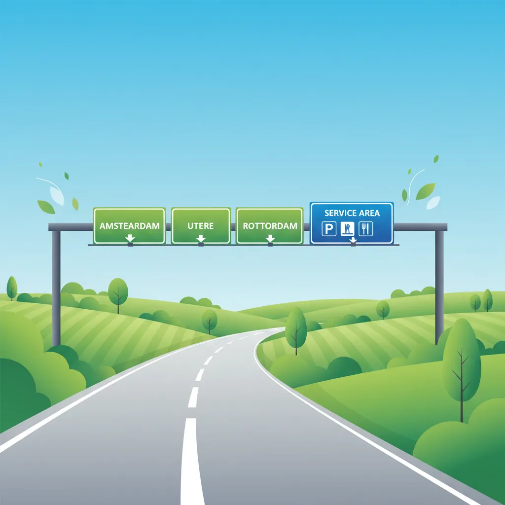
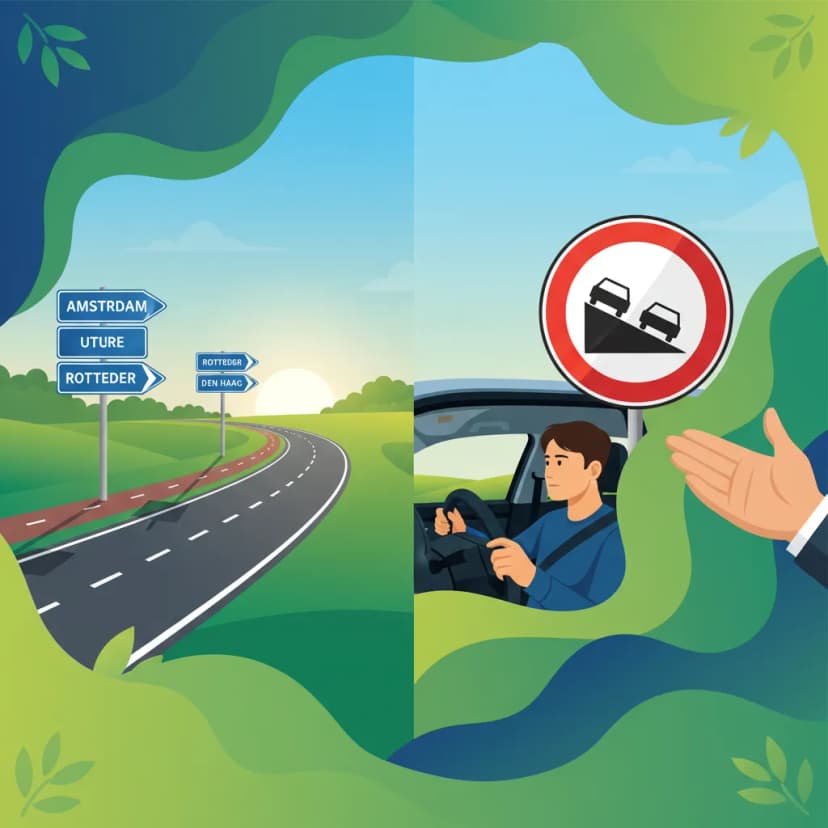
These signs are typically rectangular and white with black text, providing essential details about your travel. They indicate place names, such as cities, towns, or significant tourist attractions, along with the remaining distance in kilometres.
These signs mark primary destinations and are often seen on main routes. For example, a sign might read "Amsterdam – 30 km," indicating the distance to the city centre or a key entry point. They help riders gauge remaining travel time and plan for upcoming decisions like lane changes or turns.
Beyond major cities, these signs point to specific points of interest, industrial areas, or smaller villages. An example could be "Efteling – 12 km," guiding visitors to a theme park. These signs are crucial for local navigation and ensure you don't miss an exit for a specific attraction or area.
While there are no direct legal rules associated with these signs, they are highly practical. If a sign indicates a destination less than 5 km away and you are approaching a built-up area, it serves as an early warning to prepare for reduced speed limits. A common misunderstanding is assuming the distance shown includes the actual winding road length; it is generally measured from the sign's location via the main route.
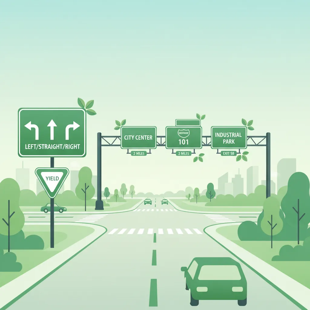
Route number signs categorize roads based on their importance and characteristics within the Dutch national road network. These signs, often accompanied by directional arrows, are crucial for long-distance navigation and understanding the expected driving conditions.
Designated by blue signs with a white 'A' followed by a number (e.g., A28), motorways are controlled-access highways with higher speed limits.
Important for Category AM Riders: Standard mopeds (bromfietsen and snorfietsen) with an engine capacity of 25cc or less, driven with a Category AM license, are generally prohibited from using motorways (A-roads). Only mopeds with an engine capacity exceeding 25cc and operated by a rider holding a full motorcycle (Category A) license may use motorways. Always verify your vehicle and license eligibility before entering a motorway.
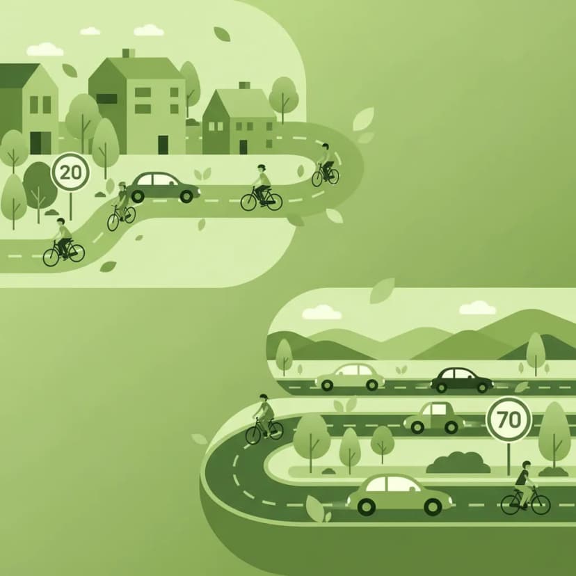
Identified by green signs with a white 'N' and a number (e.g., N58), national roads are primary non-motorway routes. They often connect major towns and cities, but unlike motorways, they may have at-grade intersections, roundabouts, and varying speed limits.
These are secondary routes managed by provinces, indicated by yellow signs with an 'S' and a number. Provincial roads typically have lower speed limits and may feature more frequent junctions, smaller villages, and dedicated moped paths.
Understanding route numbering helps you anticipate road characteristics such as lane width, traffic density, and expected speed limits. Misinterpreting a route number as a speed limit (e.g., assuming "N58" means a 58 km/h limit) is a common error; these numbers solely identify the route.
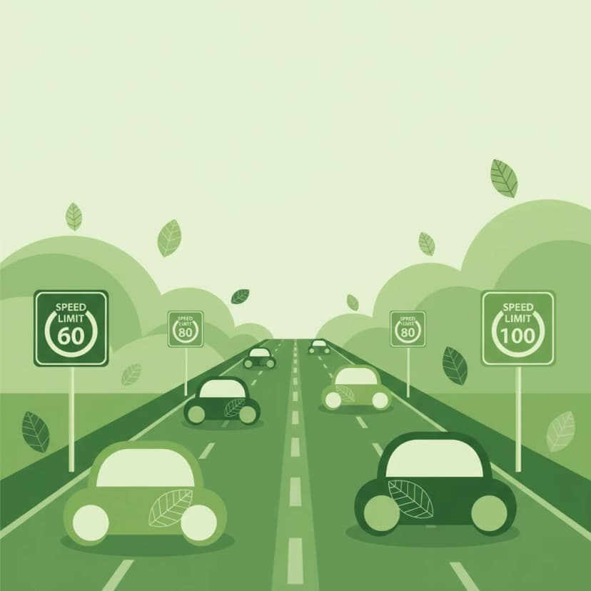
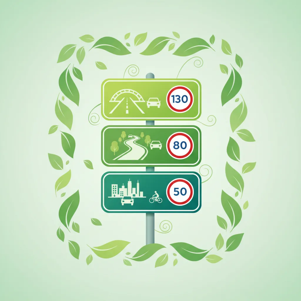
Among the most critical information signs for all road users, including Category AM riders, are those that delineate the beginning and end of a built-up area, known as "bebouwde kom" in Dutch. These signs have immediate and significant implications for applicable speed limits and overall traffic rules.
This sign indicates that you are entering an urban zone. It is typically a white rectangular sign featuring a black silhouette of houses.
Upon passing this sign, the default speed limit automatically changes to 50 km/h, unless otherwise indicated by a specific speed limit sign. You must adjust your speed before or immediately upon passing this sign. This transition requires heightened awareness due to the increased likelihood of pedestrians, cyclists, parked cars, and more complex intersections.
Conversely, this sign signals that you are exiting an urban zone. It is a white rectangular sign reading "Einde bebouwde kom."
After passing this sign, the speed limit typically reverts to the general limit for roads outside built-up areas, which is often 80 km/h, provided no other speed limit signs are present. However, it is crucial to assess the road type and conditions; do not automatically accelerate without confirming it is safe and permissible.
Immediate Speed Adjustment: For Category AM riders, it is critical to anticipate these signs. Begin decelerating well in advance of the "Begind bebouwde kom" sign to ensure your speed is 50 km/h or below as you pass it. Failure to do so can result in a speed limit violation.
Service signs are blue rectangular signs with white pictograms, indicating facilities available nearby. They are invaluable for planning breaks, refueling, or seeking assistance without having to make sudden, unplanned stops.
Common service signs include:
These signs typically indicate services within a short radius, usually around 500 meters to 2 kilometres. While there's no legal obligation to use these services, knowing they are available allows you to plan your stops safely by moving into the correct lane in advance and using designated exits. Never brake abruptly in the travel lane to access a service area.
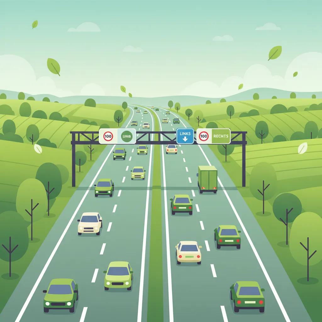
Directional arrow signs are typically white vertical panels with black arrows (e.g., ↗ for straight ahead, ↩ for left turn). They often appear in conjunction with route numbers or destination names, clarifying the mandatory direction of travel at intersections or road bifurcations.
These arrows are crucial for Category AM riders to avoid unintended lane changes or entering wrong-way streets. When a directional arrow is part of a permanent road sign system (e.g., mounted on a sign pole along with a route number like "↩ N331"), it becomes a regulatory instruction that must be obeyed. Ignoring such a sign can lead to traffic violations and dangerous situations, especially at busy intersections.
These small, rectangular signs are usually placed at regular intervals, typically every 1 kilometre, along main roads and motorways. They display a cumulative distance from a reference point, such as the start of a highway or a major city.
While they don't impose direct rules, distance markers are highly practical for navigation, estimating arrival times, and, critically, for precisely locating yourself in case of an emergency. If you need to call for assistance, knowing the nearest kilometer post number can significantly help emergency services pinpoint your location. These numbers increase continuously along a road and do not reset at municipal borders.
While information signs generally provide guidance rather than strict commands, specific regulations in the Reglement Verkeersregels en Verkeerstekens 1990 (RVV 1990 - Regulations for Traffic Rules and Traffic Signs) govern actions influenced by these signs.
| Rule | Statement | Applicability | Legal Status | Rationale |
|---|---|---|---|---|
| RVV 1990 Art. 11 – Speed limit in built-up area | The speed limit must not exceed 50 km/h once the "Begind bebouwde kom" sign is passed. | All vehicles, including Category AM mopeds, on all road types within a built-up area. | Mandatory | Reduces collision risk and severity where pedestrians and cyclists are abundant. |
| RVV 1990 Art. 8 – Use of motorways (A-roads) | Only vehicles with a motorcycle license (A) or a car license (B) may use motorways. Mopeds with an engine capacity of 25cc or less (Category AM) are prohibited from using motorways. | Motorways (A-roads) throughout the Netherlands. | Mandatory | Protects vulnerable riders from high-speed traffic and maintains safe traffic flow on motorways. |
| RVV 1990 Art. 14 – Mandatory adherence to directional signs | When a directional arrow is part of a sign post system (e.g., a permanent sign indicating "↩ N7"), the driver must follow the indicated direction. | At all intersections where such signs are permanently installed. | Mandatory | Prevents illegal lane changes, ensures consistent traffic flow, and prevents dangerous maneuvers. |
| RVV 1990 Art. 23 – Service signs are informational only | Drivers may choose to stop at service locations indicated by blue signs, but must do so in compliance with all other traffic rules (e.g., using designated pull-outs, not stopping in travel lanes). | On all roads where service signs are present. | Informational (no direct obligation to stop) | Encourages safe planning for stops without causing obstructions or hazards. |
| RVV 1990 Art. 9 – Route numbers indication | Signage displaying "A," "N," or "S" followed by a number identifies the route. Drivers must not misinterpret these signs as speed limits. | Nationwide on all designated routes. | Informational (mandatory for navigation) | Prevents confusion between route identification and actual speed limits, aiding accurate navigation. |
Misinterpreting or ignoring information signs can lead to traffic violations, hazardous situations, and inefficient travel. Category AM riders, being more vulnerable, must be particularly diligent.
Late Speed Reduction at Built-up Area Start: A frequent error is for riders to begin reducing speed only after passing the "Begind bebouwde kom" sign, briefly exceeding the 50 km/h limit. This can result in a speed ticket and, more importantly, increases the risk of collision with pedestrians or cyclists who may suddenly appear in the urban environment.
Using a Motorway with a Non-Eligible Moped: Riding a standard 25cc AM-licensed moped on an A-road is a serious violation. The consequence is a substantial fine and potential vehicle impoundment, besides the inherent danger of operating a slow-moving vehicle on a high-speed road.
Ignoring Service Sign Pull-outs: Suddenly braking or swerving into a service area upon seeing a blue "fuel" or "parking" sign, rather than planning the stop, creates a high risk of rear-end collisions, especially in heavy traffic or adverse weather.
Misreading Route Number as Speed Limit: Incorrectly assuming a sign like "N58" dictates a maximum speed of 58 km/h is a common misunderstanding. While not legally penalized, riding significantly below the actual speed limit can disrupt traffic flow and cause frustration for other road users.
Turning Against a Directional Arrow at an Intersection: Proceeding straight when a permanent sign with a directional arrow and route number (e.g., "↩ N331") mandates a left turn is a traffic violation. This can lead to collisions with crossing traffic or vehicles attempting to turn as indicated.
Failure to Recognize End of Built-up Area: Continuing to ride at 50 km/h beyond an "Einde bebouwde kom" sign on a road where 80 km/h is permitted can unnecessarily slow traffic, although it is not a penalizable offense itself.
Over-reliance on Distance Signs Without Context: Assuming the distance to a destination is static despite taking a detour or facing unexpected traffic can lead to misjudgments of remaining travel time, causing stress and potentially rushed decisions.
The effectiveness of information signs can be influenced by environmental factors and other conditions. Responsible Category AM riders adapt their interpretation and actions accordingly.
Nighttime / Low Visibility: At night or in low visibility (e.g., heavy rain, fog), directional arrows and distant signs may be harder to spot. Riders must increase vigilance, rely on reflective elements, and be prepared to react based on road markings or other cues. Reduced visibility means less time to process information.
Adverse Weather (rain, fog, snow): Service signs might be partially obscured, and built-up area signs, while high-contrast, demand an even greater reduction in speed than the legal minimum due to extended braking distances on wet or slippery surfaces. Fog severely limits sight distance, making early sign detection critical.
Road Type (Urban vs. Motorway): The density and type of information signs vary with the road. On motorways (for eligible vehicles), route number signs are more frequent, indicating higher speeds and longer distances between exits. In urban areas, service signs appear more often, and built-up area signs are the primary triggers for speed reduction.
Vehicle Condition / Load: If your moped is heavily loaded or in less-than-optimal condition, treat distance information conservatively. Longer stopping distances mean you must decelerate even earlier when approaching a "Begind bebouwde kom" sign.
Interaction with Vulnerable Road Users: The presence of a built-up area sign signals an increased likelihood of pedestrians, cyclists, and other vulnerable road users. Even if you comply with the speed limit, heightened alertness and a readiness to react are essential.
Temporary Roadworks: Temporary directional signs, often characterized by orange or yellow backgrounds, always supersede permanent signs. They may indicate detours, temporary speed reductions, or altered route numbers. Always prioritize and obey these temporary instructions to avoid entering closed or hazardous zones.
Understanding information signs is not an isolated skill; it deeply interlinks with various other aspects of driving theory, especially for Category AM riders.
This foundational knowledge also prepares you for more advanced topics, such as hazard perception, where information signs act as cues to anticipate potential dangers, and understanding how environmental factors (like weather) impact sign visibility.
Let's look at how the principles of interpreting information signs apply in real-world driving situations for a Category AM rider.
Setting: You are riding your 50cc moped on a rural road at night, approaching a village with clear visibility. Relevant Rule: RVV 1990 Art. 11 – Speed limit of 50 km/h in a built-up area. Correct Behavior: As you spot the white "Begind bebouwde kom" sign ahead, you begin to gradually reduce your speed. You ensure your moped is traveling at 50 km/h or less before your moped passes the sign. You also switch to dipped beam headlights and increase your alertness for potential pedestrians or cyclists, who are harder to see at night. Incorrect Behavior: You maintain your higher rural speed until you are directly at the sign, then brake sharply to reduce speed. This brief period of exceeding the limit within the built-up area is a speed violation and increases the risk of not being able to stop in time for an unexpected hazard.
Setting: You are on your Category AM moped and see a blue sign indicating "A28 - Zwolle" straight ahead, with a green "N377 - Coevorden" sign to the right. Relevant Rule: RVV 1990 Art. 8, paragraph 3 – Prohibits standard Category AM mopeds from using motorways (A-roads). Correct Behavior: You recognize the "A28" sign identifies a motorway, which your moped is not permitted to use. You therefore follow the green "N377" sign, taking the exit to the right to continue towards Coevorden on a national road. Incorrect Behavior: You mistakenly assume the "A28" sign means "main road" and follow it, entering the motorway. This would immediately put you in violation of the law, expose you to dangerous high-speed traffic, and could result in a significant fine and impoundment of your moped.
Setting: You're on your scooter during a heavy rain shower and notice a blue sign with a fuel pump icon indicating a fuel station 1 km ahead. Your fuel tank is low. Relevant Rule: Service signs are informational; any stop must be executed safely, especially in adverse weather. Correct Behavior: Recognizing the sign well in advance, you anticipate the need to refuel. You smoothly and gradually move into the rightmost lane, signaling your intention. You use the designated exit ramp for the fuel station, avoiding any abrupt braking or swerving. You also adjust your speed further down from the legal limit to account for increased stopping distances on the wet road. Incorrect Behavior: You only react when you are almost past the fuel sign, braking sharply in the travel lane to make the turn. This creates a dangerous situation for vehicles behind you, who may not be able to stop in time, especially on the wet surface.
Setting: As a Category AM rider, you encounter roadworks on a two-lane road. You see a permanent white directional sign indicating "N57 Straight Ahead," but also an orange temporary sign with an arrow pointing left, labeled "Omleiding" (Detour). Relevant Rule: Temporary signs (especially for roadworks) supersede permanent signs. Correct Behavior: You prioritize the temporary orange "Omleiding" sign. You signal and carefully follow the orange arrow pointing left, entering the designated temporary lane for the detour, even though the permanent sign points straight. You also reduce your speed as indicated by any accompanying temporary speed limit signs. Incorrect Behavior: You ignore the orange detour sign and continue straight, following the permanent "N57" sign. This could lead you directly into a closed road section, a construction zone, or into oncoming traffic if the road configuration has been temporarily reversed.
Lesson content overview
Explore all units and lessons included in this driving theory course.
Explore search topics learners often look for when studying Information Signs and Directional Indicators. These topics reflect common questions about road rules, driving situations, safety guidance, and lesson level theory preparation for learners in the Netherlands.
Browse additional driving theory lessons that cover connected traffic rules, road signs, and common driving situations related to this topic. Improve your understanding of how different rules interact across everyday traffic scenarios.
Learn to interpret Dutch information signs, route numbers, and directional indicators. Essential knowledge for navigating safely and understanding road rules like built-up area speed limits for your AM category theory.
This lesson focuses on the array of signs used to manage traffic at intersections and along multi-lane roads. You will learn to interpret overhead gantry signs, lane designation signs, and markings that guide drivers into the correct lane for their intended direction. The curriculum covers signs indicating priority at upcoming junctions, such as the B3 and B4 signs, which clarify right-of-way rules in complex scenarios. Proper interpretation of these signs is essential for smooth lane changes, efficient navigation, and preventing conflicts at junctions.

This lesson introduces warning signs, which are designed to alert drivers to potential dangers or changes in road layout ahead. You will learn to interpret the triangular-shaped signs that indicate hazards such as sharp curves, slippery road surfaces (J27), or upcoming road works (J8). The curriculum explains how these signs help in anticipating risks and adjusting driving behavior accordingly, such as reducing speed or increasing alertness. A thorough understanding of warning signs is vital for proactive and defensive driving in various environments.

This lesson focuses on informational signs that guide motorcyclists in navigation, route planning, and locating essential services while on the road. It examines the standardized symbols and color-coding for directions ('richtingsborden'), destinations, distances, and amenities, explaining how these signs support efficient and safe travel. Learners will understand how to use this information for strategic route selection, especially on long journeys or in unfamiliar areas, ensuring a smooth and predictable trip.
This lesson focuses on regulatory signs, which impose legal obligations on drivers and are essential for maintaining traffic order. You will learn to identify and act upon fundamental signs such as the octagonal B6 Stop sign, the diamond-shaped B1 Priority Road sign, and various compulsory direction arrows. The content explains the legal implications of these signs, detailing when a driver must stop completely, when they have priority, or the required path they must follow. Understanding these commands is crucial for safe and lawful driving at intersections and on designated routes.
This lesson explains how to interpret directional and informational signs to navigate the Dutch road network effectively. You will learn to read route signs on highways, understand lane guidance arrows for complex intersections, and identify panels indicating services like fuel stations or rest areas. The content focuses on how motorcyclists can use this information for safe and efficient route planning, including adapting to real-time information from electronic signs.

This lesson covers the full range of lights and signals required on a vehicle for visibility and communication. You will learn about the mandatory requirements for headlights, taillights, brake lights, indicators, and reflectors. The curriculum emphasizes the driver's legal responsibility to ensure all lights are clean and functional before every journey. The correct use and function of the horn as an audible warning device in case of imminent danger are also explained.
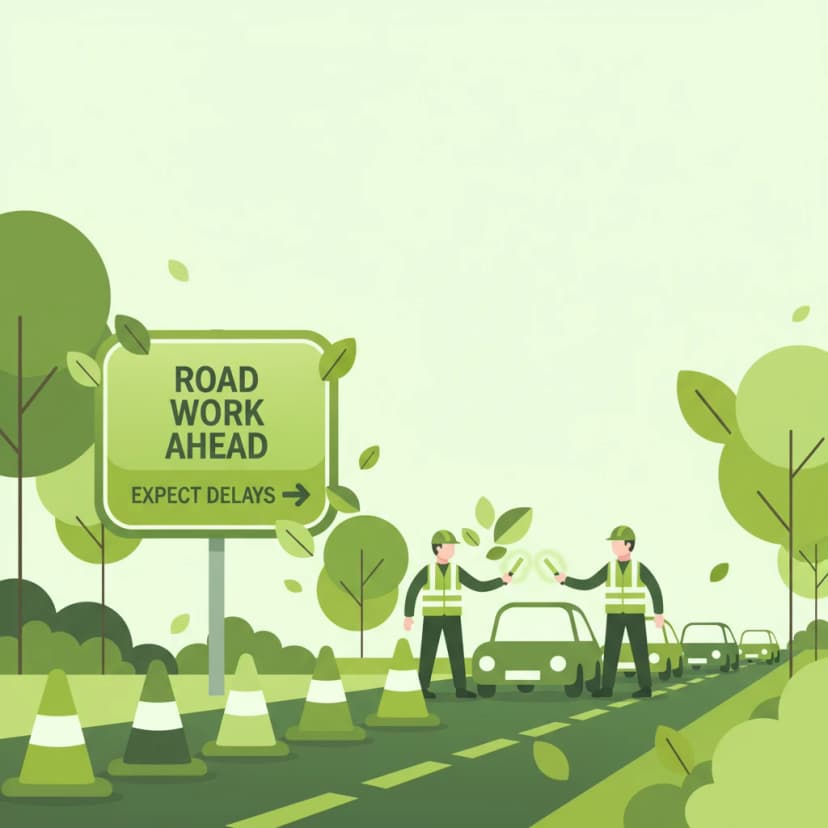
This lesson prepares you for encountering road works, a common feature on any road network. You will learn that signs and markings related to road works are often yellow and that they temporarily override permanent white markings and signs. The curriculum stresses the importance of adhering to temporary speed limits, being alert for workers and machinery, and navigating narrowed lanes. It also covers how to follow diversion routes ('omleiding') and obey instructions given by traffic controllers.
This lesson focuses on B-code signs, which provide essential information for navigation and route planning. It explains how to read directional signs for cities and motorways, understand route numbering, and identify signs for services like fuel stations or rest areas. For motorcyclists, clear and quick interpretation of these signs is vital for smooth navigation, especially when making decisions about lane changes for upcoming exits or junctions.
This lesson offers an in-depth study of Dutch regulatory signs, which impose mandatory actions or prohibitions on road users, with a specific focus on their impact on motorcyclists. It explains the visual language of prohibition symbols ('verbodsborden') and obligation symbols ('verplichtingsborden'), the contexts in which they appear, and the strict statutory consequences of non-compliance. Real-world examples are used to illustrate how these signs directly influence route planning, overtaking decisions, and speed management.
This lesson explores the legal meaning of various road surface markings, including solid and broken lane delimiters, directional arrows, and special-purpose lane indicators. It describes how markings dictate permitted maneuvers, such as overtaking and lane changes, and alert riders to upcoming hazards or changes in road layout. The content also examines the relationship between markings and road design in the Netherlands, emphasizing how a motorcyclist must interpret these visual cues for safe positioning.
Master the Dutch road network by understanding A, N, and S road classifications and their associated speed limits. This lesson clarifies the implications of entering and exiting built-up areas ('bebouwde kom') for Category AM riders.
This lesson focuses on the specific speed regulations for major highways in the Netherlands. You will learn to identify an 'autosnelweg' (motorway, G1 sign), where the speed limit is 100 km/h between 6:00 and 19:00 and often 130 km/h at other times, unless indicated otherwise. The lesson also covers the 'autoweg' (expressway, G3 sign), which typically has a speed limit of 100 km/h. Furthermore, you will study dynamic speed limits indicated on electronic signs, which can change due to traffic or weather conditions.
This lesson provides a detailed overview of fixed speed limits on the Dutch road network and the signs that indicate them. You will learn to identify signs for maximum speed (BORD 50) and understand the default limits that apply within built-up areas, on rural roads, and on motorways. The content emphasizes the importance of constant awareness and legal compliance to avoid penalties and ensure road safety for yourself and others.
This lesson details the default speed limits that apply in the absence of specific signs. You will learn to recognize the signs (H1 and H2) that mark the beginning and end of a built-up area, where the default speed limit is 50 km/h. Outside these areas, on non-highway roads, the standard limit is 80 km/h. The content explains the rationale behind these limits, which are based on factors like pedestrian density, road design, and potential hazards, ensuring you can apply the correct speed in any location.
This lesson covers the specific articles of the Dutch Road Traffic Act that apply to motorways, with a primary focus on the strict rule of keeping to the rightmost available lane unless overtaking. It explains the legal and safety reasons for only passing on the left and discusses the correct positioning within a lane for maximum visibility and safety. The content also addresses the nuances of lane usage during heavy congestion, ensuring riders comply with the law and contribute to smooth traffic flow.

This lesson details the specific regulations for driving on Dutch motorways, identifiable by the G1 sign. You will learn the correct procedure for joining the flow of traffic using the acceleration lane and for leaving via the deceleration lane. The curriculum reinforces the 'keep right unless overtaking' rule for lane discipline. It also explains that stopping is strictly forbidden, and the hard shoulder (vluchtstrook) may only be used for genuine emergencies.
This lesson provides a definitive guide to the legal speed limits on different types of Dutch roads. It covers the rules for built-up areas (typically 50 km/h), rural roads (80 km/h), expressways ('autowegen'), and motorways ('snelwegen'), including time-dependent variations. Understanding these official limits is the first step in managing speed legally and appropriately for the road environment, a core topic on the CBR theory test.
This lesson explains how to respond to variable speed limits shown on overhead electronic signs, which are used to manage traffic flow in real-time. You will learn why these limits are adjusted for factors like congestion, accidents, or bad weather, and the legal requirement to obey them. The content focuses on the importance of anticipatory riding, scanning far ahead for these signs to allow for smooth and safe speed adjustments.
This lesson focuses on the unique demands of riding at sustained high speeds on motorways ('snelwegen'). It covers essential topics such as strict lane discipline, safe overtaking procedures, and maintaining a greater following distance to compensate for higher reaction and braking times. The content also addresses the physical and mental challenges, including managing wind blast, increased noise levels, and maintaining heightened situational awareness over long distances to combat fatigue.
This lesson clarifies the features of an 'autoweg,' indicated by the G3 sign. Unlike motorways, autowegen can have intersections at the same level (crossroads and traffic lights) and generally lack a hard shoulder. You will learn to recognize different types of autowegen by their central road markings, which indicate the speed limit and whether overtaking is permitted. Understanding these distinctions is crucial for applying the correct speed and driving behavior on these high-speed roads.
This lesson focuses on regulatory signs, which impose legal obligations on drivers and are essential for maintaining traffic order. You will learn to identify and act upon fundamental signs such as the octagonal B6 Stop sign, the diamond-shaped B1 Priority Road sign, and various compulsory direction arrows. The content explains the legal implications of these signs, detailing when a driver must stop completely, when they have priority, or the required path they must follow. Understanding these commands is crucial for safe and lawful driving at intersections and on designated routes.
Find clear answers to common questions learners have about Information Signs and Directional Indicators. Learn how the lesson is structured, which driving theory objectives it supports, and how it fits into the overall learning path of units and curriculum progression in the Netherlands. These explanations help you understand key concepts, lesson flow, and exam focused study goals.
Directional signs specifically guide you towards destinations like cities, towns, or specific exits, often including route numbers. Information signs are a broader category that includes directional signs, but also signs indicating services (like petrol stations or parking), points of interest, or regulatory information like the start/end of a built-up area.
The 'bebouwde kom' (built-up area) signs indicate the start and end of a zone where different traffic rules and speed limits typically apply. Upon entering, you must usually adhere to a lower speed limit (often 50 km/h for bromfietsen and snorfietsen, unless otherwise indicated) and be more aware of pedestrians and cyclists.
Yes, standard information signs indicating services like petrol stations, restaurants, and parking areas are used throughout the Netherlands. While not exclusively for mopeds, these signs help all road users, including AM category riders, locate necessary facilities.
Route number signs are important as they help you understand the road network. Knowing how to interpret signs for motorways (A-roads), national roads (N-roads), and provincial roads is tested, as it relates to understanding permitted routes and speed differences. The exam will check if you can correctly identify and follow route indicators.
In case of conflicting directions, first check if one sign is for a major route (like an A or N road) and the other is for a local destination. Generally, follow the signs for the major route you intend to take. Always prioritize safety and obey any immediate regulatory signs or traffic lights. If unsure, proceed cautiously and consider pulling over safely to re-orient yourself.